Patricroft from the air
Introduction
The photograph on this page of Patricroft from the air by Thomas Nugent as part of the Geograph project.
The Geograph project started in 2005 with the aim of publishing, organising and preserving representative images for every square kilometre of Great Britain, Ireland and the Isle of Man.

There are currently over 7.5m images from over 14,400 individuals and you can help contribute to the project by visiting https://www.geograph.org.uk
Patricroft from the air
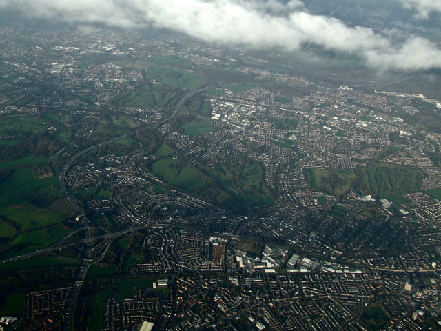
Image: © Thomas Nugent Taken: 10 Nov 2014
The M60 and M602 run horizontally through the bottom of the photo, the M60 runs vertically on the left. They all meet at the junction in the lower left corner.
Images are licensed for reuse under creativecommons.org/licenses/by-sa/2.0
Image Location
Latitude
53.482644
Longitude
-2.370659