Welwyn Garden City: The White Bridge (1)
Introduction
The photograph on this page of Welwyn Garden City: The White Bridge (1) by Nigel Cox as part of the Geograph project.
The Geograph project started in 2005 with the aim of publishing, organising and preserving representative images for every square kilometre of Great Britain, Ireland and the Isle of Man.

There are currently over 7.5m images from over 14,400 individuals and you can help contribute to the project by visiting https://www.geograph.org.uk
Welwyn Garden City: The White Bridge (1)
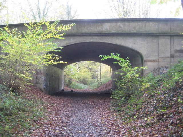
Image: © Nigel Cox Taken: 15 Nov 2014
Looking somewhat less than white from this angle the bridge was built in 1925 to replace the level crossing on Digswell Road, where it crossed the former Great Northern Railway's branch line between Welwyn Junction and Luton. The bridge became necessary as the development of Welwyn Garden City began in the 1920s. The railway had been opened in 1860 and was finally closed in 1965. The bridge represents the eastern end of the Ayot Greenway.
Images are licensed for reuse under creativecommons.org/licenses/by-sa/2.0
Image Location
Latitude
51.806189
Longitude
-0.206956