Wateresk standing stone near Dundrum
Introduction
The photograph on this page of Wateresk standing stone near Dundrum by Rossographer as part of the Geograph project.
The Geograph project started in 2005 with the aim of publishing, organising and preserving representative images for every square kilometre of Great Britain, Ireland and the Isle of Man.

There are currently over 7.5m images from over 14,400 individuals and you can help contribute to the project by visiting https://www.geograph.org.uk
Wateresk standing stone near Dundrum
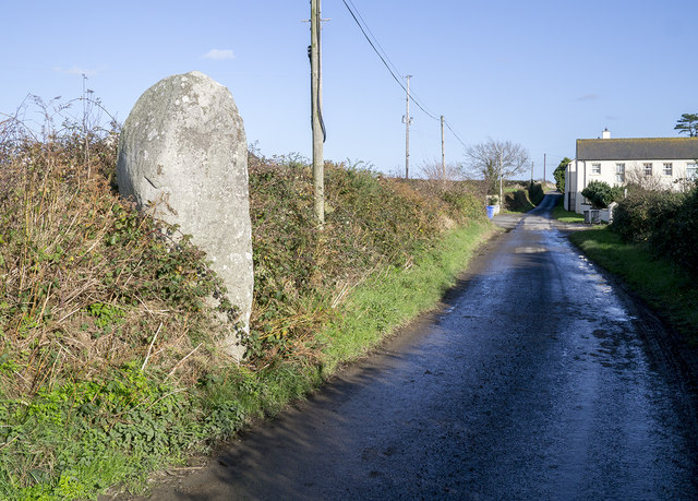
Image: © Rossographer Taken: 5 Nov 2014
Standing stone (one of two but the other is smaller and hidden inside the hedge) on the Flush Road near the village of Maghera in County Down. It is the remains of a large megalithic structure close to a souterrain in a nearby field.
Images are licensed for reuse under creativecommons.org/licenses/by-sa/2.0
Image Location
Latitude
54.237897
Longitude
-5.867456