Cockton's Yard
Introduction
The photograph on this page of Cockton's Yard by Rose and Trev Clough as part of the Geograph project.
The Geograph project started in 2005 with the aim of publishing, organising and preserving representative images for every square kilometre of Great Britain, Ireland and the Isle of Man.

There are currently over 7.5m images from over 14,400 individuals and you can help contribute to the project by visiting https://www.geograph.org.uk
Cockton's Yard
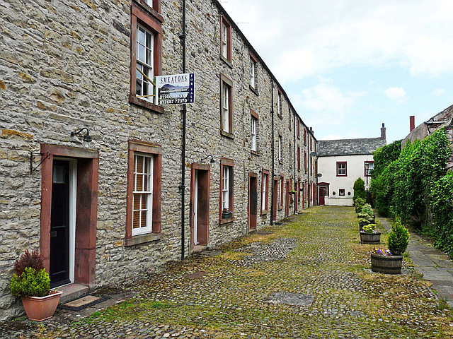
Image: © Rose and Trev Clough Taken: 27 Jun 2014
A row of early 19th century workers' houses, built on what was a medieval burgage plot (long narrow strip of land behind a town house fronting onto the street). Pedestrian access to the yard is a passageway between shops on Main Street, modern residents also have car parking spaces to the rear. The scene doesn't appear to have changed since this photo was taken in 2003 Image .
Images are licensed for reuse under creativecommons.org/licenses/by-sa/2.0
Image Location
Latitude
54.664116
Longitude
-3.366134