Sheen Vale Congregational Church - now Thompson House School
Introduction
The photograph on this page of Sheen Vale Congregational Church - now Thompson House School by Stefan Czapski as part of the Geograph project.
The Geograph project started in 2005 with the aim of publishing, organising and preserving representative images for every square kilometre of Great Britain, Ireland and the Isle of Man.

There are currently over 7.5m images from over 14,400 individuals and you can help contribute to the project by visiting https://www.geograph.org.uk
Sheen Vale Congregational Church - now Thompson House School
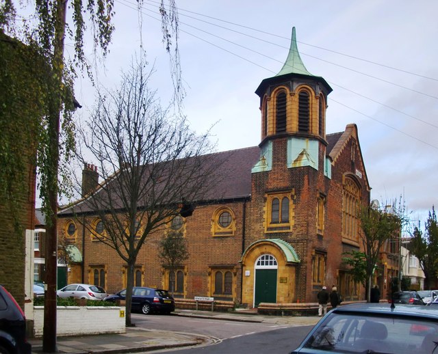
Image: © Stefan Czapski Taken: 7 Nov 2014
At the corner of Vernon Road and Howgate Road. A foundation stone is dated 1901: http://www.geograph.org.uk/photo/4240392 I notice that in older OS mappings the church is represented by a simple cross. The octagonal tower (vaguely Greek-looking) with its curious roof - shaped like the trumpet on an early gramophone - apparently didn't qualify it for either the 'church with tower' or 'church with spire' symbols that were the convention until recently.
Images are licensed for reuse under creativecommons.org/licenses/by-sa/2.0
Image Location
Latitude
51.466805
Longitude
-0.265642