Cane Hill Asylum
Introduction
The photograph on this page of Cane Hill Asylum by Peter Trimming as part of the Geograph project.
The Geograph project started in 2005 with the aim of publishing, organising and preserving representative images for every square kilometre of Great Britain, Ireland and the Isle of Man.

There are currently over 7.5m images from over 14,400 individuals and you can help contribute to the project by visiting https://www.geograph.org.uk
Cane Hill Asylum
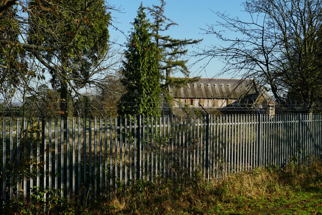
Image: © Peter Trimming Taken: 6 Nov 2014
Looking towards the chapel of Cane Hill Asylum. The hospital opened in two phases, in 1882 and in 1888 as the Third Surrey County Lunatic Asylum. Demolition of Cane Hill started in March 2008 and was completed by the end of 2010. Only the Chapel, Administration building and Water Tower remained. On 13 November 2010 a fire took hold in the administration block and went on to destroy all but the front facade of the building. The fire also destroyed the iconic clock tower.
Images are licensed for reuse under creativecommons.org/licenses/by-sa/2.0
Image Location
Latitude
51.31234
Longitude
-0.149938