James Square View
Introduction
The photograph on this page of James Square View by Mary and Angus Hogg as part of the Geograph project.
The Geograph project started in 2005 with the aim of publishing, organising and preserving representative images for every square kilometre of Great Britain, Ireland and the Isle of Man.

There are currently over 7.5m images from over 14,400 individuals and you can help contribute to the project by visiting https://www.geograph.org.uk
James Square View
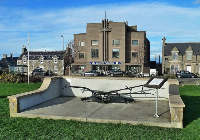
Image: © Mary and Angus Hogg Taken: 26 Oct 2014
This open space was part of an 1830s improvement plan known as Branderburgh, named after the owner of the ground, Lt.Col. James Brander, Laird of Pitgaveny. A century later, the new Laird tried to prove ownership by having the square ploughed up. The matter was settled quickly with the ground eventually being given to the town council. The actual plough that was used is on display here. In the background, in the next square, is a former cinema now occupied by Grampian Furnishers. For more information, see Image
Images are licensed for reuse under creativecommons.org/licenses/by-sa/2.0
Image Location


Leaflet Map data © OpenStreetMap
Latitude
57.721978
Longitude
-3.284103