Former St Paul's school, Plumstead
Introduction
The photograph on this page of Former St Paul's school, Plumstead by Stephen Craven as part of the Geograph project.
The Geograph project started in 2005 with the aim of publishing, organising and preserving representative images for every square kilometre of Great Britain, Ireland and the Isle of Man.

There are currently over 7.5m images from over 14,400 individuals and you can help contribute to the project by visiting https://www.geograph.org.uk
Former St Paul's school, Plumstead
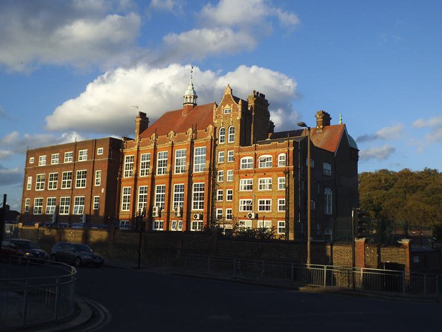
Image: © Stephen Craven Taken: 1 Nov 2014
Originally a Catholic secondary school, more recently an Academy. The Academy has now moved to a new site about 1.5km away Image and I am unsure what this old building is used for now. The high-stacked temporary buildings used for a while when the academy first expanded on this site Image have now gone.
Images are licensed for reuse under creativecommons.org/licenses/by-sa/2.0
Image Location
Latitude
51.479644
Longitude
0.103668