Dawson's Heights, Overhill Road (2)
Introduction
The photograph on this page of Dawson's Heights, Overhill Road (2) by Stephen Richards as part of the Geograph project.
The Geograph project started in 2005 with the aim of publishing, organising and preserving representative images for every square kilometre of Great Britain, Ireland and the Isle of Man.

There are currently over 7.5m images from over 14,400 individuals and you can help contribute to the project by visiting https://www.geograph.org.uk
Dawson's Heights, Overhill Road (2)
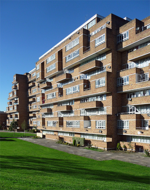
Image: © Stephen Richards Taken: 1 Nov 2014
A landmark building due to its elevated position, its craggy, stepped silhouette appearing as a man-made extension to the hill atop which it stands. Its 300 flats, each with its own balcony, are in two parallel ranges separated by a green space. In contrast to many public housing projects of the time - it was built in 1964-72 - it is clad in brown brick. Designed by Southwark Architect's Department. A listing application in 2012 by the Twentieth Century Society was rejected despite being supported by English Heritage.
Images are licensed for reuse under creativecommons.org/licenses/by-sa/2.0
Image Location
Latitude
51.447507
Longitude
-0.066767