Holcombe Hill
Introduction
The photograph on this page of Holcombe Hill by John Tomlinson as part of the Geograph project.
The Geograph project started in 2005 with the aim of publishing, organising and preserving representative images for every square kilometre of Great Britain, Ireland and the Isle of Man.

There are currently over 7.5m images from over 14,400 individuals and you can help contribute to the project by visiting https://www.geograph.org.uk
Holcombe Hill
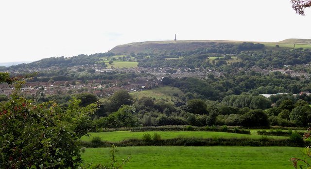
Image: © John Tomlinson Taken: 14 Aug 2014
View from Park across the Irwell Valley towards Holcombe Hill topped by the Peel Monument erected by public subscription in 1852 to celebrate Sir Robert Peel who had been responsible for the repeal of the Corn Laws and the establishment of a paid police force. The houses are built along Nuttall Lane which was once a main route to Nuttall Hall (now demolished) and Nuttall Village. They are built along a moraine left at the end of the last ice age and blocking the River Irwell which has cut a deep gorge just to the left of the picture towards Summerseat
Images are licensed for reuse under creativecommons.org/licenses/by-sa/2.0
Image Location
Latitude
53.641259
Longitude
-2.318202