Horton from the air
Introduction
The photograph on this page of Horton from the air by Thomas Nugent as part of the Geograph project.
The Geograph project started in 2005 with the aim of publishing, organising and preserving representative images for every square kilometre of Great Britain, Ireland and the Isle of Man.

There are currently over 7.5m images from over 14,400 individuals and you can help contribute to the project by visiting https://www.geograph.org.uk
Horton from the air
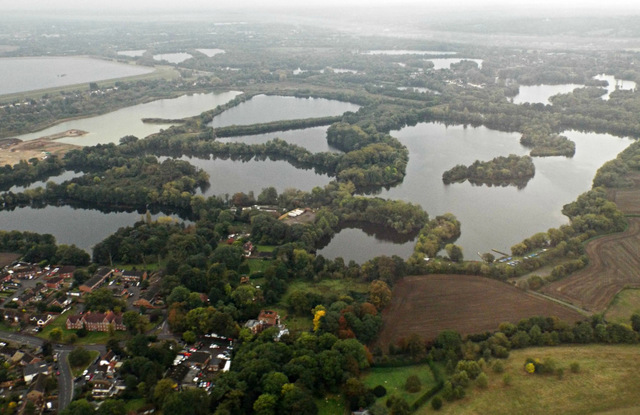
Image: © Thomas Nugent Taken: 8 Oct 2014
Almost surrounded by water. Taken shortly before touchdown at Heathrow runway 09L from the west on a flight from Glasgow.
Images are licensed for reuse under creativecommons.org/licenses/by-sa/2.0
Image Location
Latitude
51.472025
Longitude
-0.543625