High Street
Introduction
The photograph on this page of High Street by Alan Walker as part of the Geograph project.
The Geograph project started in 2005 with the aim of publishing, organising and preserving representative images for every square kilometre of Great Britain, Ireland and the Isle of Man.

There are currently over 7.5m images from over 14,400 individuals and you can help contribute to the project by visiting https://www.geograph.org.uk
High Street
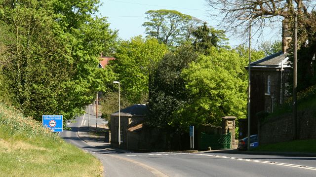
Image: © Alan Walker Taken: 30 Apr 2007
The photograph shows High Street (A170), Brompton-By-Sawdon and was taken from near to Image (the building in shadow on the right). Brompton Hall was once the manorial home of the Cayley family (Sir George Cayley http://www.scienceandsociety.co.uk/results.asp?x9=CAYLEY,+GEORGE,+SIR who is often described as ‘Father of Aerial Navigation’ http://firstflight.open.ac.uk/cayley/cayley.html lived here), then a hotel and now a school http://www.bromptonhall.n-yorks.sch.uk/ . Ahead the A170 continues toward Ruston whilst behind the viewpoint the road is from Snainton. For a more easterly (ahead) photograph of High Street, click here Image For a more westerly (behind the viewpoint) photograph of High Street, click here Image
Images are licensed for reuse under creativecommons.org/licenses/by-sa/2.0
Image Location
Latitude
54.227189
Longitude
-0.553773