Wales on the right, England on the left near Presteigne
Introduction
The photograph on this page of Wales on the right, England on the left near Presteigne by Jaggery as part of the Geograph project.
The Geograph project started in 2005 with the aim of publishing, organising and preserving representative images for every square kilometre of Great Britain, Ireland and the Isle of Man.

There are currently over 7.5m images from over 14,400 individuals and you can help contribute to the project by visiting https://www.geograph.org.uk
Wales on the right, England on the left near Presteigne
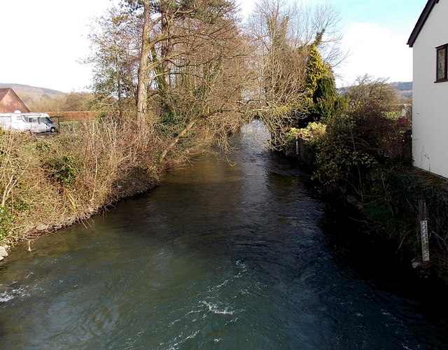
Image: © Jaggery Taken: 19 Mar 2014
Viewed from this http://www.geograph.org.uk/photo/4213213 bridge looking along the River Lugg, which here marks a county and national boundary. Presteigne, Powys and Wales to the right. Stapleton, Herefordshire and England to the left. A river height gauge is at the edge of the house on the right.
Images are licensed for reuse under creativecommons.org/licenses/by-sa/2.0
Image Location
Latitude
52.275197
Longitude
-3.002595