Laundry Lane Crossing: towards Newmarket
Introduction
The photograph on this page of Laundry Lane Crossing: towards Newmarket by John Sutton as part of the Geograph project.
The Geograph project started in 2005 with the aim of publishing, organising and preserving representative images for every square kilometre of Great Britain, Ireland and the Isle of Man.

There are currently over 7.5m images from over 14,400 individuals and you can help contribute to the project by visiting https://www.geograph.org.uk
Laundry Lane Crossing: towards Newmarket
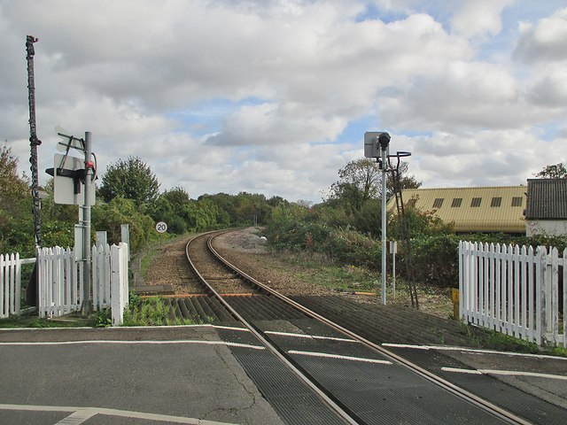
Image: © John Sutton Taken: 19 Oct 2014
The line to Newmarket, Bury St Edmunds and Stowmarket curving sharply away from the junction with the main line. Because the bend is so sharp there is a continuous check rail and a 20 mph speed limit. The crossing is currently ungated, but half-barriers are in place, wrapped in black plastic and not yet operational. Image] is the view in the opposite direction.
Images are licensed for reuse under creativecommons.org/licenses/by-sa/2.0
Image Location


Leaflet Map data © OpenStreetMap
Latitude
52.208105
Longitude
0.149181