Wynard's Almshouses
Introduction
The photograph on this page of Wynard's Almshouses by Neil Owen as part of the Geograph project.
The Geograph project started in 2005 with the aim of publishing, organising and preserving representative images for every square kilometre of Great Britain, Ireland and the Isle of Man.

There are currently over 7.5m images from over 14,400 individuals and you can help contribute to the project by visiting https://www.geograph.org.uk
Wynard's Almshouses
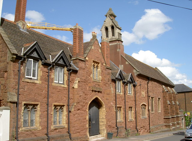
Image: © Neil Owen Taken: 20 Aug 2014
These almshouses owe their existence to a William Wynard, a Recorder of Exeter, who established them in 1435. It appears that he benefited from a certain amount of gain from the proceeds of piracy - but many nobles did in those days. The almshouses offered shelter for twelve poor and infirm people, and were subject to a lot of modernisation and improvements over the centuries - today's Heavitree red stone façade with a central doorway is more Victorian in character. After a threat to demolish them in 1967, the council released the almshouses to be converted for the Citizen's Advice Bureau, and they later became private residences. Grade II listed.
Images are licensed for reuse under creativecommons.org/licenses/by-sa/2.0
Image Location
Latitude
50.720409
Longitude
-3.526632