Stalbridge Weston (2)
Introduction
The photograph on this page of Stalbridge Weston (2) by Mike Searle as part of the Geograph project.
The Geograph project started in 2005 with the aim of publishing, organising and preserving representative images for every square kilometre of Great Britain, Ireland and the Isle of Man.

There are currently over 7.5m images from over 14,400 individuals and you can help contribute to the project by visiting https://www.geograph.org.uk
Stalbridge Weston (2)
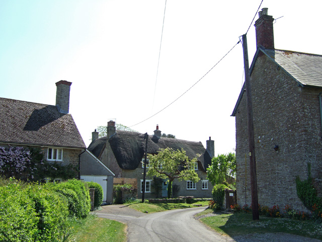
Image: © Mike Searle Taken: 1 May 2007
The thatched house is The Old Orchard, and dates back in part to the 16th Century, the rest being mainly 18th century. It is listed Grade II. The coursed rubble exterior belies the fact that is a cruck-framed house.
Images are licensed for reuse under creativecommons.org/licenses/by-sa/2.0
Image Location


Leaflet Map data © OpenStreetMap
Latitude
50.947967
Longitude
-2.400803