Swine Green
Introduction
The photograph on this page of Swine Green by Derek Harper as part of the Geograph project.
The Geograph project started in 2005 with the aim of publishing, organising and preserving representative images for every square kilometre of Great Britain, Ireland and the Isle of Man.

There are currently over 7.5m images from over 14,400 individuals and you can help contribute to the project by visiting https://www.geograph.org.uk
Swine Green
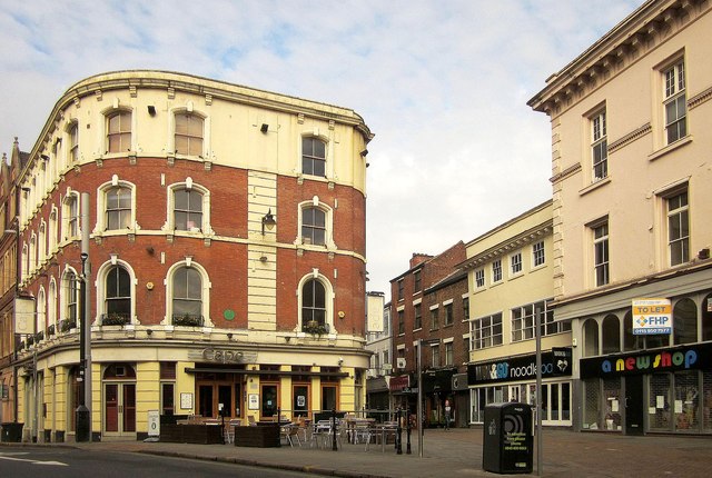
Image: © Derek Harper Taken: 11 Oct 2014
As John points out at Image, the plaque on the Cape bar commemorates Swine Green, where "as far back as 1408 and possibly earlier, the local swineherd would collect the swine of the town each morning and drive them out to their feeding ground at the Coppice and other areas. In the evening they were brought back to Swine Green and some were also kept there for the night" http://www.pastscape.org.uk/hob.aspx?hob_id=317655 . Any comparison with current night-time denizens who frequent the local bars is coincidental. On the right is Pelham Street, with a former Lloyd's Bank on the extreme right http://list.english-heritage.org.uk/resultsingle.aspx?uid=1271309&searchtype=mapsearch .
Images are licensed for reuse under creativecommons.org/licenses/by-sa/2.0
Image Location
Latitude
52.953495
Longitude
-1.145586