Brassworks Bridge south-east of Stone, Staffordshire
Introduction
The photograph on this page of Brassworks Bridge south-east of Stone, Staffordshire by Roger D Kidd as part of the Geograph project.
The Geograph project started in 2005 with the aim of publishing, organising and preserving representative images for every square kilometre of Great Britain, Ireland and the Isle of Man.

There are currently over 7.5m images from over 14,400 individuals and you can help contribute to the project by visiting https://www.geograph.org.uk
Brassworks Bridge south-east of Stone, Staffordshire
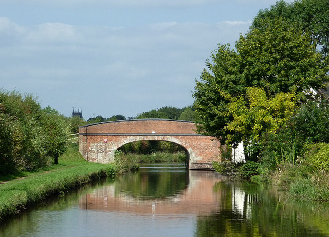
Image: © Roger D Kidd Taken: 2 Sep 2014
There was a brass foundry nearby which is recalled by the name of this bridge and the nearby 18th century farm house. This bridge (No 91 across the Trent and Mersey Canal) would have been an accommodation bridge allowing farm access to riverside pastures before the land to the right was developed for housing. Maybe livestock can still be brought through the housing in transporters - the bridge is still in use. St Michael's Church tower can be seen on the skyline.
Images are licensed for reuse under creativecommons.org/licenses/by-sa/2.0
Image Location


Leaflet Map data © OpenStreetMap
Latitude
52.891317
Longitude
-2.132537