Totnes from Fishchowter's Lane
Introduction
The photograph on this page of Totnes from Fishchowter's Lane by Derek Harper as part of the Geograph project.
The Geograph project started in 2005 with the aim of publishing, organising and preserving representative images for every square kilometre of Great Britain, Ireland and the Isle of Man.

There are currently over 7.5m images from over 14,400 individuals and you can help contribute to the project by visiting https://www.geograph.org.uk
Totnes from Fishchowter's Lane
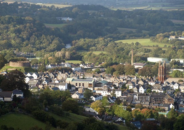
Image: © Derek Harper Taken: 8 Oct 2014
A good view of the town centre from Totnes Bridleway 21, with the castle on the left, St Mary's church tower on the right, and the prominent creamery chimney by the railway station. Beyond is a glimpse of the Dart, with the Dartington estate behind on the left.
Images are licensed for reuse under creativecommons.org/licenses/by-sa/2.0
Image Location
Latitude
50.430276
Longitude
-3.689479