Drumlin and inter-drumlin wetland east of Bonecastle Road
Introduction
The photograph on this page of Drumlin and inter-drumlin wetland east of Bonecastle Road by Eric Jones as part of the Geograph project.
The Geograph project started in 2005 with the aim of publishing, organising and preserving representative images for every square kilometre of Great Britain, Ireland and the Isle of Man.

There are currently over 7.5m images from over 14,400 individuals and you can help contribute to the project by visiting https://www.geograph.org.uk
Drumlin and inter-drumlin wetland east of Bonecastle Road
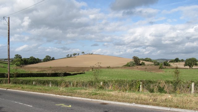
Image: © Eric Jones Taken: 2 Oct 2014
This image was taken from the Bonecastle/Vianstown Cross Roads. The contrasts in the agricultural potential between the well-drained drumlin slopes and the waterlogged inter-drumlin hollow are obvious.
Images are licensed for reuse under creativecommons.org/licenses/by-sa/2.0
Image Location
Latitude
54.304804
Longitude
-5.737358