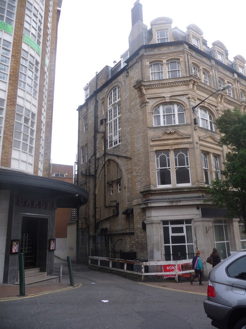
Bournemouth: remains of the Scotch Church
Introduction
The photograph on this page of Bournemouth: remains of the Scotch Church by Chris Downer as part of the Geograph project.
The Geograph project started in 2005 with the aim of publishing, organising and preserving representative images for every square kilometre of Great Britain, Ireland and the Isle of Man.
There are currently over 7.5m images from over 14,400 individuals and you can help contribute to the project by visiting https://www.geograph.org.uk

Image: © Chris Downer Taken: 10 Oct 2014
Looking down a delivery alleyway alongside NatWest's Bournemouth branch (see Image), we can clearly see the church-like archway built into the bank's side wall. This was the Scotch Church, which had originally been an iron building here, built in 1858. It was replaced by a stone building abutting the then Hotel Empress in 1872, and was replaced by St. Andrew's church (see Image - it originally had a tall spire on top) in 1886. We are therefore looking at the remnants of a building which only lasted 14 years, and was demolished, presumably, around 125 years ago. The building just in shot on the left is Bristol & West House (see Image).

