OS benchmark - Smethwick, Holy Trinity church
Introduction
The photograph on this page of OS benchmark - Smethwick, Holy Trinity church by Richard Law as part of the Geograph project.
The Geograph project started in 2005 with the aim of publishing, organising and preserving representative images for every square kilometre of Great Britain, Ireland and the Isle of Man.

There are currently over 7.5m images from over 14,400 individuals and you can help contribute to the project by visiting https://www.geograph.org.uk
OS benchmark - Smethwick, Holy Trinity church
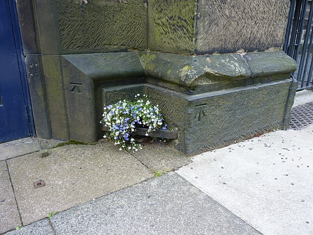
Image: © Richard Law Taken: 11 Aug 2014
An OS cutmark (along with something that is probably the building mason's mark to its left) near the doorway of Holy Trinity church in the centre of Smethwick. Originally levelled at 163.187m above Ordnance Datum Newlyn.
Images are licensed for reuse under creativecommons.org/licenses/by-sa/2.0
Image Location
Latitude
52.494675
Longitude
-1.971544