The White Hart, Bridge Street, Brigg
Introduction
The photograph on this page of The White Hart, Bridge Street, Brigg by David Wright as part of the Geograph project.
The Geograph project started in 2005 with the aim of publishing, organising and preserving representative images for every square kilometre of Great Britain, Ireland and the Isle of Man.

There are currently over 7.5m images from over 14,400 individuals and you can help contribute to the project by visiting https://www.geograph.org.uk
The White Hart, Bridge Street, Brigg
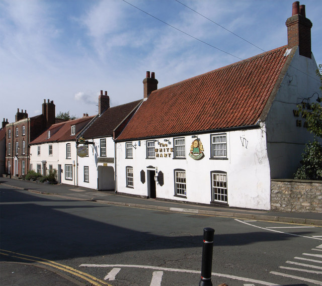
Image: © David Wright Taken: 5 Oct 2014
Grade II listed building. "Mid C18. 2 storeys in painted roughcast with pantile roof with stone coped gable ends and 2 brick stacks. 4 windows, modern glazing. 3 windows to ground floor with segmental arches, 1 with hung sashes with glazing bars. Panelled door. Dated 1749 on brick beside door, but possibly earlier origins." http://www.britishlistedbuildings.co.uk/en-165466-white-hart-public-house-brigg-
Images are licensed for reuse under creativecommons.org/licenses/by-sa/2.0
Image Location


Leaflet Map data © OpenStreetMap
Latitude
53.55168
Longitude
-0.494789