
Old Kiln and New Houses
Introduction
The photograph on this page of Old Kiln and New Houses by Des Blenkinsopp as part of the Geograph project.
The Geograph project started in 2005 with the aim of publishing, organising and preserving representative images for every square kilometre of Great Britain, Ireland and the Isle of Man.

There are currently over 7.5m images from over 14,400 individuals and you can help contribute to the project by visiting https://www.geograph.org.uk
Old Kiln and New Houses
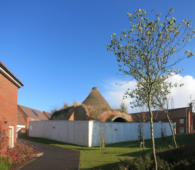
Image: © Des Blenkinsopp Taken: 7 Oct 2014
This area was the site of a large cement works. See this industrial view Image from 1986 to see what it used to be like. Pre-dating all that, built in 1908 and operative until 1938, this old kiln would have been in the middle of the industrial area but somehow managed to survive. All the rest of this big site has been cleared and a new small village built on the land, but the kiln is now a listed structure http://www.britishlistedbuildings.co.uk/en-480823-beehive-lime-kiln-chinnor-oxfordshire and sits in its enclosure in the middle of all the brand new houses while someone decides what best to do about it.
Images are licensed for reuse under creativecommons.org/licenses/by-sa/2.0
Image Location

Latitude
51.694657
Longitude
-0.907468