Corbett's Wharf, Bermondsey
Introduction
The photograph on this page of Corbett's Wharf, Bermondsey by Robin Webster as part of the Geograph project.
The Geograph project started in 2005 with the aim of publishing, organising and preserving representative images for every square kilometre of Great Britain, Ireland and the Isle of Man.

There are currently over 7.5m images from over 14,400 individuals and you can help contribute to the project by visiting https://www.geograph.org.uk
Corbett's Wharf, Bermondsey
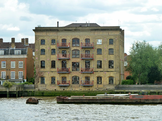
Image: © Robin Webster Taken: 30 Jun 2011
That is its current name on the street (Bermondsey Wall East), but across the top is 'Naylo.....Wharf' in faded lettering. The grade II listing citation gives its alternative name as Naylor's Wharf. The large obliterated interval in the lettering suggests it might have had '& Co' or similar in the middle.
Images are licensed for reuse under creativecommons.org/licenses/by-sa/2.0
Image Location
Latitude
51.500557
Longitude
-0.060921