The Circular Road, Belfast (October 2014)
Introduction
The photograph on this page of The Circular Road, Belfast (October 2014) by Albert Bridge as part of the Geograph project.
The Geograph project started in 2005 with the aim of publishing, organising and preserving representative images for every square kilometre of Great Britain, Ireland and the Isle of Man.

There are currently over 7.5m images from over 14,400 individuals and you can help contribute to the project by visiting https://www.geograph.org.uk
The Circular Road, Belfast (October 2014)
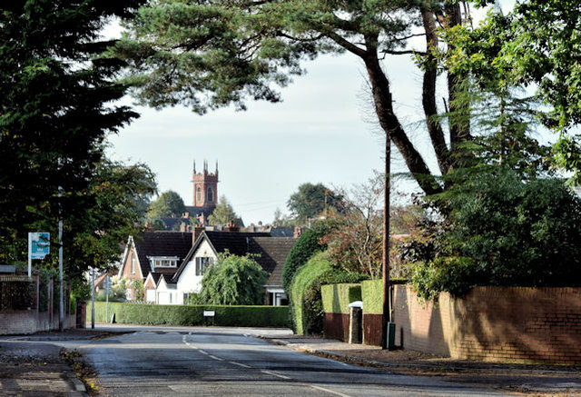
Image: © Albert Bridge Taken: 7 Oct 2014
A suburban road running in a loop on the south eastern side of the Holywood Road. The 1901 street directory shows only a few houses, cottages and gate lodges at the Station Road end. Completion was after WW1. Before it was built the name “Circular Road” referred to a road off the Antrim Road - later re-named “North Circular Road” Image This view is from near “CI” Image looking towards Sydenham Avenue Image with the tower of Belmont Presbyterian church http://www.geograph.org.uk/snippet/7848 at middle left.
Images are licensed for reuse under creativecommons.org/licenses/by-sa/2.0
Image Location
Latitude
54.604397
Longitude
-5.861613