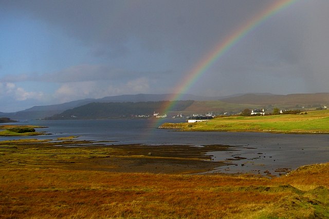
Kinloch Follart
Introduction
The photograph on this page of Kinloch Follart by Tiger as part of the Geograph project.
The Geograph project started in 2005 with the aim of publishing, organising and preserving representative images for every square kilometre of Great Britain, Ireland and the Isle of Man.
There are currently over 7.5m images from over 14,400 individuals and you can help contribute to the project by visiting https://www.geograph.org.uk

Image: © Tiger Taken: 4 Oct 2014
Loch Follart (variously spelt) is the western branch of the head of Loch Dunvegan. Alexander Forbes in "Place-names of Skye" (Paisley, 1923) derives its name from "Paul's Firth", referring to one Paul Balkasson who was the son of Bakki or Boke, Sheriff of Skye in 1223. "Near here fine agates are said to have been found, while topazes, rock crystals and other more or less precious stones, inseparable from the igneous rocks of the island generally, are often discovered by painstaking searchers, chiefly in burns and among mountain torrents' debris." The peninsula in the middle ground divides Loch Follart from the head of Loch Dunvegan proper; the white house with a hipped roof between two chimneys is the former Church of Scotland manse for Duirinish parish. In the distance behind the rainbow can be seen part of Dunvegan village.

