Old Mill Farmhouse
Introduction
The photograph on this page of Old Mill Farmhouse by Alan Murray-Rust as part of the Geograph project.
The Geograph project started in 2005 with the aim of publishing, organising and preserving representative images for every square kilometre of Great Britain, Ireland and the Isle of Man.

There are currently over 7.5m images from over 14,400 individuals and you can help contribute to the project by visiting https://www.geograph.org.uk
Old Mill Farmhouse
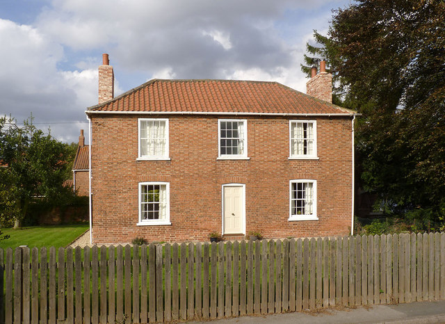
Image: © Alan Murray-Rust Taken: 28 Sep 2014
Late 18th century farmhouse, the roof being a 20th century rebuilding. Listed Grade II. The listing description of 1985 includes the chimney stacks, but the Google Streetview view of the house at the time of submission shows the house without them, so they had clearly been recently rebuilt. Update 2021: I have received a comment from a former resident who states that the house was originally Old Hall Farm, but the name was changed to Old Mill Farm in 1984 when the Old Hall was split into two dwellings, one of which was then named 'Old Hall Farmhouse'. There had been a mill on the site together with a bakery at the house. At the time, the farm buildings to the rear, seen here https://www.geograph.org.uk/photo/4191235 were still unconverted.
Images are licensed for reuse under creativecommons.org/licenses/by-sa/2.0
Image Location
Latitude
53.36315
Longitude
-0.857454