Inchterf 'Secret' Bunker, Kirkintilloch
Introduction
The photograph on this page of Inchterf 'Secret' Bunker, Kirkintilloch by Raymond Okonski as part of the Geograph project.
The Geograph project started in 2005 with the aim of publishing, organising and preserving representative images for every square kilometre of Great Britain, Ireland and the Isle of Man.

There are currently over 7.5m images from over 14,400 individuals and you can help contribute to the project by visiting https://www.geograph.org.uk
Inchterf 'Secret' Bunker, Kirkintilloch
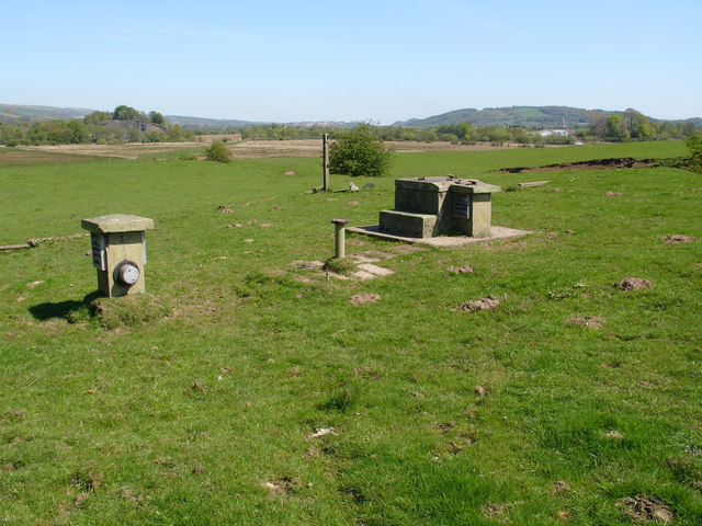
Image: © Raymond Okonski Taken: 30 Apr 2007
Easily seen from the nearby A803, the hatch is still secured with substantial padlocks, no signs exist, and the perimeter fencing has collapsed. The hill in the distance is Barr Hill, home to a Roman Fort and a defensive position on the Antonine Wall... an unusual link between old and new. In the middle distance is a Sand Pit, previously home to Inchterf (MOD PE) part of the Directorate of Proof & Experimental Establishment belonging to DERA. Presumably the bunker was for the local top-brass? No explosions have been heard from here since it closed in the early 1990's.
Images are licensed for reuse under creativecommons.org/licenses/by-sa/2.0
Image Location
Latitude
55.955532
Longitude
-4.129519