De Havilland DH95 (Flamingo) R2764
Introduction
The photograph on this page of De Havilland DH95 (Flamingo) R2764 by Ian S as part of the Geograph project.
The Geograph project started in 2005 with the aim of publishing, organising and preserving representative images for every square kilometre of Great Britain, Ireland and the Isle of Man.

There are currently over 7.5m images from over 14,400 individuals and you can help contribute to the project by visiting https://www.geograph.org.uk
De Havilland DH95 (Flamingo) R2764
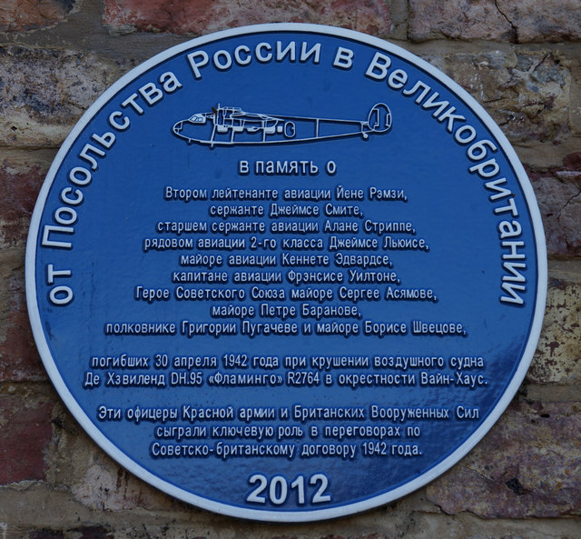
Image: © Ian S Taken: 30 Sep 2014
Site of the war time crash. The plaque is in Russian. For the English plaque see here, http://www.geograph.org.uk/photo/4187457. http://www.geograph.org.uk/photo/4187460
Images are licensed for reuse under creativecommons.org/licenses/by-sa/2.0
Image Location


Leaflet Map data © OpenStreetMap
Latitude
54.048676
Longitude
-1.313896