All Saints' Doddinghurst
Introduction
The photograph on this page of All Saints' Doddinghurst by Bikeboy as part of the Geograph project.
The Geograph project started in 2005 with the aim of publishing, organising and preserving representative images for every square kilometre of Great Britain, Ireland and the Isle of Man.

There are currently over 7.5m images from over 14,400 individuals and you can help contribute to the project by visiting https://www.geograph.org.uk
All Saints' Doddinghurst
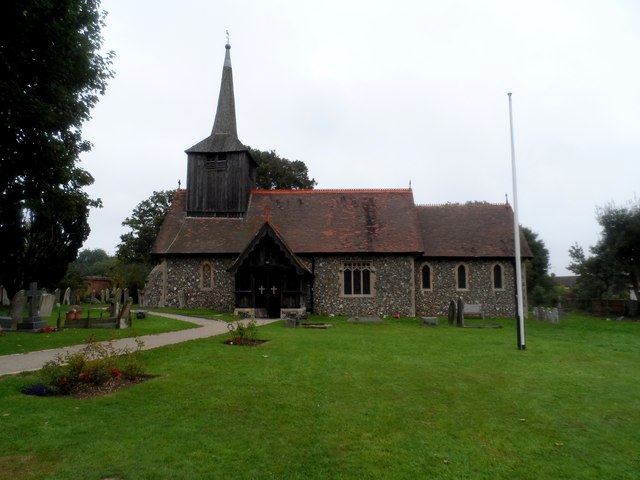
Image: © Bikeboy Taken: 13 Sep 2014
The earliest parts date from C13 although most of the structure was rebuilt 1866-7. The timber-frame porch is C16.
Images are licensed for reuse under creativecommons.org/licenses/by-sa/2.0
Image Location
Latitude
51.667308
Longitude
0.296448