Damer's Farm, Chaldon Herring, Dorset
Introduction
The photograph on this page of Damer's Farm, Chaldon Herring, Dorset by Edmund Shaw as part of the Geograph project.
The Geograph project started in 2005 with the aim of publishing, organising and preserving representative images for every square kilometre of Great Britain, Ireland and the Isle of Man.

There are currently over 7.5m images from over 14,400 individuals and you can help contribute to the project by visiting https://www.geograph.org.uk
Damer's Farm, Chaldon Herring, Dorset
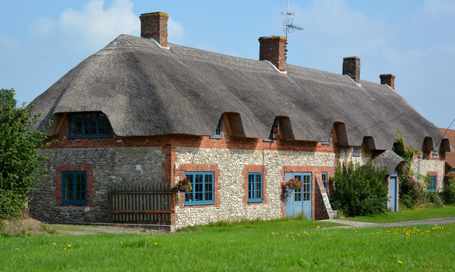
Image: © Edmund Shaw Taken: 8 Sep 2014
The central part of the cottage is 17th century, where the dormer windows are lower. Either side are modern extensions.
Images are licensed for reuse under creativecommons.org/licenses/by-sa/2.0
Image Location


Leaflet Map data © OpenStreetMap
Latitude
50.649904
Longitude
-2.296843