Croesgoch cottages
Introduction
The photograph on this page of Croesgoch cottages by Natasha Ceridwen de Chroustchoff as part of the Geograph project.
The Geograph project started in 2005 with the aim of publishing, organising and preserving representative images for every square kilometre of Great Britain, Ireland and the Isle of Man.

There are currently over 7.5m images from over 14,400 individuals and you can help contribute to the project by visiting https://www.geograph.org.uk
Croesgoch cottages
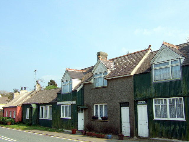
Image: © Natasha Ceridwen de Chroustchoff Taken: 29 Apr 2007
This photograph of a row of cottages along the A487 road at Croesgoch includes the one on the right pictured in the first Geograph http://www.geograph.org.uk/photo/67936. It's easy to see why the name means Four(th) Door House. The pink cottage on the left is Trefeigan, older but only slightly more traditional that these tin houses still occasionally to be seen in Pembrokeshire.
Images are licensed for reuse under creativecommons.org/licenses/by-sa/2.0
Image Location
Latitude
51.927844
Longitude
-5.159889