Spronkett's Lane
Introduction
The photograph on this page of Spronkett's Lane by Simon Carey as part of the Geograph project.
The Geograph project started in 2005 with the aim of publishing, organising and preserving representative images for every square kilometre of Great Britain, Ireland and the Isle of Man.

There are currently over 7.5m images from over 14,400 individuals and you can help contribute to the project by visiting https://www.geograph.org.uk
Spronkett's Lane
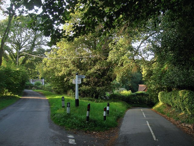
Image: © Simon Carey Taken: 19 Sep 2014
A view of the road junction with Cross Colwood Lane which heads off down the slope to the right. Earwig Lane was once part of this junction but has had its status reduced to that of bridleway. Obscured by the tree is Image whilst a small part of Bee House Cottage can be seen to the right.
Images are licensed for reuse under creativecommons.org/licenses/by-sa/2.0
Image Location
Latitude
51.003263
Longitude
-0.231959