Barrow Upon Trent, The Row
Introduction
The photograph on this page of Barrow Upon Trent, The Row by David Dixon as part of the Geograph project.
The Geograph project started in 2005 with the aim of publishing, organising and preserving representative images for every square kilometre of Great Britain, Ireland and the Isle of Man.

There are currently over 7.5m images from over 14,400 individuals and you can help contribute to the project by visiting https://www.geograph.org.uk
Barrow Upon Trent, The Row
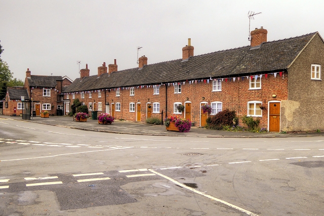
Image: © David Dixon Taken: 19 Sep 2014
This attractive row of ten cottages, known as "The Row" in the centre of the village, is owned by the parish council http://www.barrowupontrentparish.co.uk/blog/ not as a housing authority, nor as alms houses, but uniquely to Barrow as private property rented to people with village connections. The cottages date from the late-18th century and are Grade II-listed (English Heritage Building ID: 82693 http://www.britishlistedbuildings.co.uk/en-82693-2-18-twyford-road-barrow-upon-trent-derby British Listed Buildings). The parish council also owns "The Pinfold", a small walled area originally used for holding stray cattle.
Images are licensed for reuse under creativecommons.org/licenses/by-sa/2.0
Image Location
Latitude
52.853386
Longitude
-1.47738