Sacombe: Lowgate Lane Roman Road
Introduction
The photograph on this page of Sacombe: Lowgate Lane Roman Road by Nigel Cox as part of the Geograph project.
The Geograph project started in 2005 with the aim of publishing, organising and preserving representative images for every square kilometre of Great Britain, Ireland and the Isle of Man.

There are currently over 7.5m images from over 14,400 individuals and you can help contribute to the project by visiting https://www.geograph.org.uk
Sacombe: Lowgate Lane Roman Road
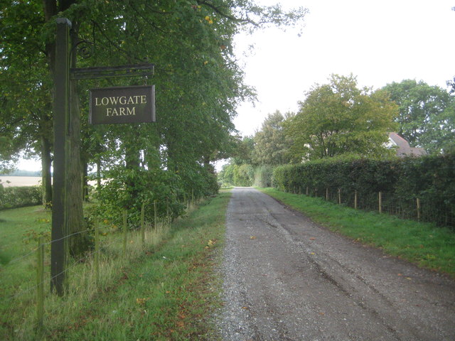
Image: © Nigel Cox Taken: 21 Sep 2014
Lowgate Lane leading to Lowgate Farm forms a section of a secondary Roman Road, which linked the settlements of the region. Unlike the major roads such as Watling Street and Ermine Street, which were built to allow the strategic movement of military forces soon after the Roman Conquest and maintained thereafter as a tool of the provincial government, these lesser routes are generally thought to have developed in the second and third centuries AD to serve the emerging pattern of urban and rural settlement. Such roads, sometimes formalising far older routes, are thought to have been the responsibility of local government, and their construction emphasises the importance that the territorial capital (in this case Verulamium) placed on providing effective links between town and country. This section is now a Public Byway.
Images are licensed for reuse under creativecommons.org/licenses/by-sa/2.0
Image Location
Latitude
51.863701
Longitude
-0.035757