Nos 38&40 University Road, Belfast (September 2014)
Introduction
The photograph on this page of Nos 38&40 University Road, Belfast (September 2014) by Albert Bridge as part of the Geograph project.
The Geograph project started in 2005 with the aim of publishing, organising and preserving representative images for every square kilometre of Great Britain, Ireland and the Isle of Man.

There are currently over 7.5m images from over 14,400 individuals and you can help contribute to the project by visiting https://www.geograph.org.uk
Nos 38&40 University Road, Belfast (September 2014)
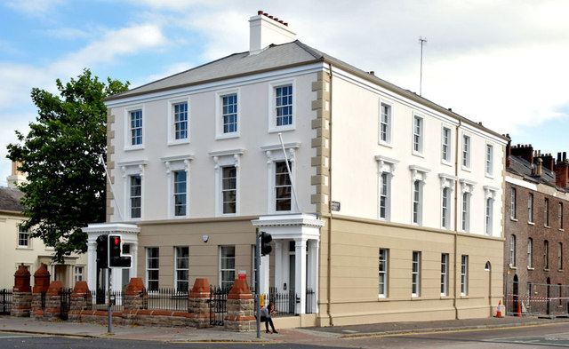
Image: © Albert Bridge Taken: 20 Sep 2014
A pair of Victorian semis, built before 1877 and listed as HB26/27/006, recently used by the Open University. They became an eyesore, with peeling paint, following the University’s move to other accommodation. Now looking exceptionally well after a spell hidden by plastic sheeting while the painters were at work. They sit between Mount Charles and University Street (right).
Images are licensed for reuse under creativecommons.org/licenses/by-sa/2.0
Image Location
Latitude
54.58619
Longitude
-5.935898