Trent Bridge, Newark
Introduction
The photograph on this page of Trent Bridge, Newark by Paul Harrop as part of the Geograph project.
The Geograph project started in 2005 with the aim of publishing, organising and preserving representative images for every square kilometre of Great Britain, Ireland and the Isle of Man.

There are currently over 7.5m images from over 14,400 individuals and you can help contribute to the project by visiting https://www.geograph.org.uk
Trent Bridge, Newark
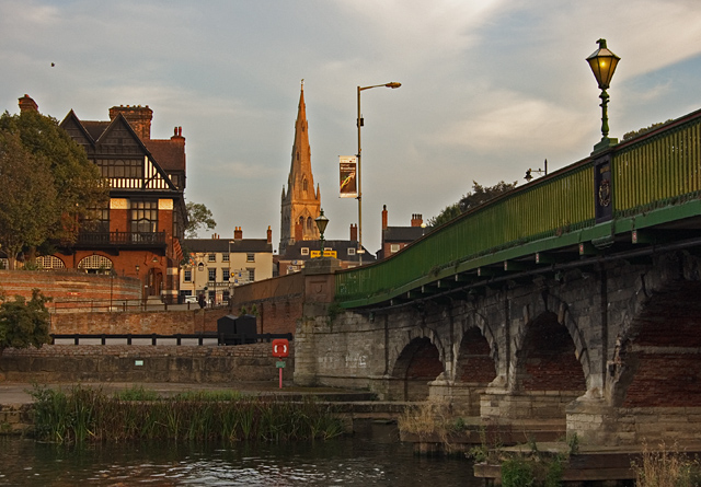
Image: © Paul Harrop Taken: 18 Sep 2014
Grade 2 listed bridge over the River Trent dating from 1775, seen from the western bank footpath, with the Ossington on the left and St Mary Magdalene Church in the distance.
Images are licensed for reuse under creativecommons.org/licenses/by-sa/2.0
Image Location
Latitude
53.078375
Longitude
-0.812309