Road markings, Greencastle, Belfast (September 2014)
Introduction
The photograph on this page of Road markings, Greencastle, Belfast (September 2014) by Albert Bridge as part of the Geograph project.
The Geograph project started in 2005 with the aim of publishing, organising and preserving representative images for every square kilometre of Great Britain, Ireland and the Isle of Man.

There are currently over 7.5m images from over 14,400 individuals and you can help contribute to the project by visiting https://www.geograph.org.uk
Road markings, Greencastle, Belfast (September 2014)
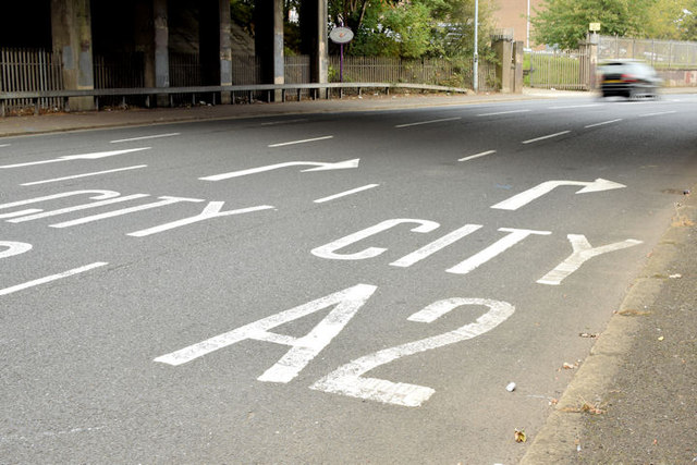
Image: © Albert Bridge Taken: 19 Sep 2014
The buildings of the M2 (north approach road) back in the 1960’s http://www.wesleyjohnston.com/roads/m2.html necessitated the introduction of a one-way system on part of the Shore Road from just north of Gray’s Lane http://www.geograph.org.uk/snippet/11933 to just south of Mount Street. The two lanes on the left are for outward traffic heading towards Whiteabbey and Rathcoole. Second right is the lane for inward traffic via the M2. The lane on the right is for inward traffic along the Shore Road. The inward lanes of the M2 are almost overhead.
Images are licensed for reuse under creativecommons.org/licenses/by-sa/2.0
Image Location
Latitude
54.648179
Longitude
-5.919741