Radford: Kennington Road
Introduction
The photograph on this page of Radford: Kennington Road by John Sutton as part of the Geograph project.
The Geograph project started in 2005 with the aim of publishing, organising and preserving representative images for every square kilometre of Great Britain, Ireland and the Isle of Man.

There are currently over 7.5m images from over 14,400 individuals and you can help contribute to the project by visiting https://www.geograph.org.uk
Radford: Kennington Road
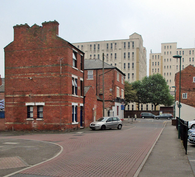
Image: © John Sutton Taken: 16 Sep 2014
Looking across the corner of Medway Street towards Wollaton Road and Player's Bonded Warehouse. Many of the Victorian terraces in this area - which, older Nottinghamians will remember, was once known as Sodom - were demolished in the 1970s. To the right, where the railings are, there was once a long terrace. The building on the left-hand corner of Wollaton Road, next to the 30mph sign, was once The Midland Hotel and the shop on the right was once a Shipstone's off-licence (or beer-off).
Images are licensed for reuse under creativecommons.org/licenses/by-sa/2.0
Image Location


Leaflet Map data © OpenStreetMap
Latitude
52.955495
Longitude
-1.187226