Signposts to Enterkin Pass
Introduction
The photograph on this page of Signposts to Enterkin Pass by Eileen Henderson as part of the Geograph project.
The Geograph project started in 2005 with the aim of publishing, organising and preserving representative images for every square kilometre of Great Britain, Ireland and the Isle of Man.

There are currently over 7.5m images from over 14,400 individuals and you can help contribute to the project by visiting https://www.geograph.org.uk
Signposts to Enterkin Pass
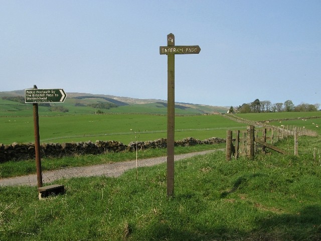
Image: © Eileen Henderson Taken: 28 Apr 2007
The start of the footpath north to the Enterkin Pass and beyond to Wanlockhead is marked not by one, but by two, signposts. The green sign on the left was erected by the Scottish Rights of Way Society, while the taller one on the right bears the inscription "CT". The road seen in the photo leads to Inglestone Farm.
Images are licensed for reuse under creativecommons.org/licenses/by-sa/2.0
Image Location


Leaflet Map data © OpenStreetMap
Latitude
55.32253
Longitude
-3.776413