Holy Trinity Parish Church, Oswestry
Introduction
The photograph on this page of Holy Trinity Parish Church, Oswestry by Jaggery as part of the Geograph project.
The Geograph project started in 2005 with the aim of publishing, organising and preserving representative images for every square kilometre of Great Britain, Ireland and the Isle of Man.

There are currently over 7.5m images from over 14,400 individuals and you can help contribute to the project by visiting https://www.geograph.org.uk
Holy Trinity Parish Church, Oswestry
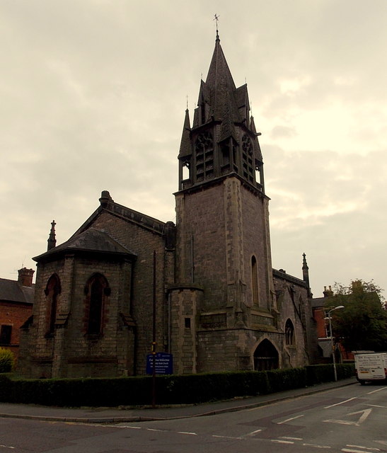
Image: © Jaggery Taken: 15 Sep 2014
The Roft Street and Salop Road corner of the church, viewed from Middleton Road. The church is part of the Church of England Diocese of Lichfield.
Images are licensed for reuse under creativecommons.org/licenses/by-sa/2.0
Image Location


Leaflet Map data © OpenStreetMap
Latitude
52.857425
Longitude
-3.051906