U.S.A. Fried Chicken in Oswestry
Introduction
The photograph on this page of U.S.A. Fried Chicken in Oswestry by Jaggery as part of the Geograph project.
The Geograph project started in 2005 with the aim of publishing, organising and preserving representative images for every square kilometre of Great Britain, Ireland and the Isle of Man.

There are currently over 7.5m images from over 14,400 individuals and you can help contribute to the project by visiting https://www.geograph.org.uk
U.S.A. Fried Chicken in Oswestry
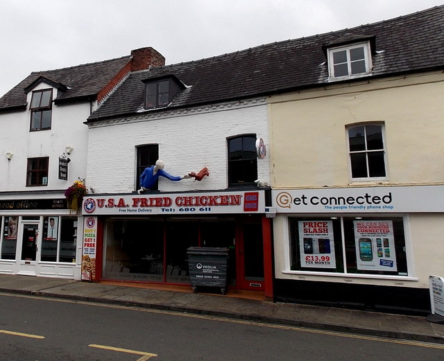
Image: © Jaggery Taken: 15 Sep 2014
The depiction of a blue-shirted man in a window of 20 Willow Street reaching out to catch a fleeing chicken is certainly eye-catching, but it is more likely to attract or deter potential customers?
Images are licensed for reuse under creativecommons.org/licenses/by-sa/2.0
Image Location


Leaflet Map data © OpenStreetMap
Latitude
52.859632
Longitude
-3.056416