Gloucester Docks Branch No.3 viaduct: a closer view
Introduction
The photograph on this page of Gloucester Docks Branch No.3 viaduct: a closer view by John Winder as part of the Geograph project.
The Geograph project started in 2005 with the aim of publishing, organising and preserving representative images for every square kilometre of Great Britain, Ireland and the Isle of Man.

There are currently over 7.5m images from over 14,400 individuals and you can help contribute to the project by visiting https://www.geograph.org.uk
Gloucester Docks Branch No.3 viaduct: a closer view
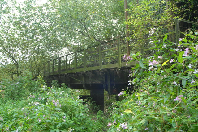
Image: © John Winder Taken: 13 Sep 2014
Here you can see the footbridge, added to the viaduct in 1941 to give access to a nearby power station, now long gone. There's no decking on the viaduct or its footbridge and it would be foolhardy in the extreme to go clambering about on the structure for the sake of getting some interesting photographs. You'd have to do battle with some pretty dense vegetation too, including the Himalayan Balsam prominent in the foreground of this shot.
Images are licensed for reuse under creativecommons.org/licenses/by-sa/2.0
Image Location
Latitude
51.862638
Longitude
-2.25844