7-9 Laura Place
Introduction
The photograph on this page of 7-9 Laura Place by Ian Capper as part of the Geograph project.
The Geograph project started in 2005 with the aim of publishing, organising and preserving representative images for every square kilometre of Great Britain, Ireland and the Isle of Man.

There are currently over 7.5m images from over 14,400 individuals and you can help contribute to the project by visiting https://www.geograph.org.uk
7-9 Laura Place
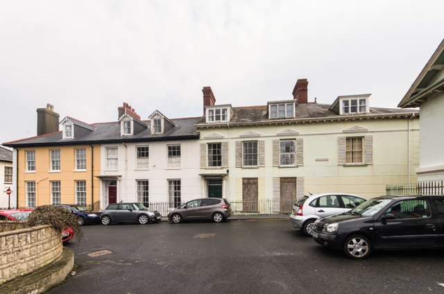
Image: © Ian Capper Taken: 29 Mar 2014
Early 19th century housing originally conceived by W E Powell of Nanteos and named after his wife Laura. This is nos 7 - 9 (see Image for a wider view). Grade II* listed - see http://cadwpublic-api.azurewebsites.net/reports/listedbuilding/FullReport?lang=en&id=10263 (although in practice each building is separately listed).
Images are licensed for reuse under creativecommons.org/licenses/by-sa/2.0
Image Location
Latitude
52.414078
Longitude
-4.087556