Blorenge looms behind Llanfoist's moraine
Introduction
The photograph on this page of Blorenge looms behind Llanfoist's moraine by Alan Bowring as part of the Geograph project.
The Geograph project started in 2005 with the aim of publishing, organising and preserving representative images for every square kilometre of Great Britain, Ireland and the Isle of Man.

There are currently over 7.5m images from over 14,400 individuals and you can help contribute to the project by visiting https://www.geograph.org.uk
Blorenge looms behind Llanfoist's moraine
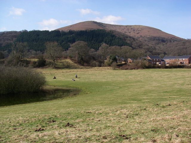
Image: © Alan Bowring Taken: 21 Mar 2010
Much of Llanfoist is built on the Llanfoist-Nevil Hall moraine, deposited by a receding Usk valley glacier during the last ice age. The wooded pool in the foreground does not appear on Ordnance Survey maps yet is an enduring feature, filling a large hollow in the moraine. Cwm Craf on the front face of Blorenge beyond is likely to be a nivation hollow rather than a glacial cirque.
Images are licensed for reuse under creativecommons.org/licenses/by-sa/2.0
Image Location
Latitude
51.81205
Longitude
-3.02608