Haxey Water Tower from the South: aerial 2014
Introduction
The photograph on this page of Haxey Water Tower from the South: aerial 2014 by Chris as part of the Geograph project.
The Geograph project started in 2005 with the aim of publishing, organising and preserving representative images for every square kilometre of Great Britain, Ireland and the Isle of Man.

There are currently over 7.5m images from over 14,400 individuals and you can help contribute to the project by visiting https://www.geograph.org.uk
Haxey Water Tower from the South: aerial 2014
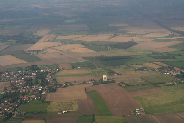
Image: © Chris Taken: 10 Sep 2014
Haxey village is off shot to the right, with Upperthorpe and Westwoodside to the left (west). The water tower is a prominent feature from the air, hence Haxey has been designated a VRP (Visual Reporting Point) for aircraft arriving and departing Doncaster Airport. In practice aircraft, at least when flying east-west or west-east, seem to be asked to report simply when reaching the A1 or the River Trent.
Images are licensed for reuse under creativecommons.org/licenses/by-sa/2.0
Image Location
Latitude
53.489162
Longitude
-0.85603