Semaphore signal along disused railway trackbed at Silverdale
Introduction
The photograph on this page of Semaphore signal along disused railway trackbed at Silverdale by Jonathan Hutchins as part of the Geograph project.
The Geograph project started in 2005 with the aim of publishing, organising and preserving representative images for every square kilometre of Great Britain, Ireland and the Isle of Man.

There are currently over 7.5m images from over 14,400 individuals and you can help contribute to the project by visiting https://www.geograph.org.uk
Semaphore signal along disused railway trackbed at Silverdale
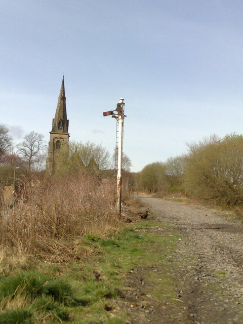
Image: © Jonathan Hutchins Taken: 5 Apr 2009
As late as eleven years after the last coal train left Silverdale, a rusting semaphore signal is still in situ. In the background is the spire of St Luke's Church, Silverdale.
Images are licensed for reuse under creativecommons.org/licenses/by-sa/2.0
Image Location
Latitude
53.017468
Longitude
-2.27215