Station platforms, Mansfield
Introduction
The photograph on this page of Station platforms, Mansfield by Richard Vince as part of the Geograph project.
The Geograph project started in 2005 with the aim of publishing, organising and preserving representative images for every square kilometre of Great Britain, Ireland and the Isle of Man.

There are currently over 7.5m images from over 14,400 individuals and you can help contribute to the project by visiting https://www.geograph.org.uk
Station platforms, Mansfield
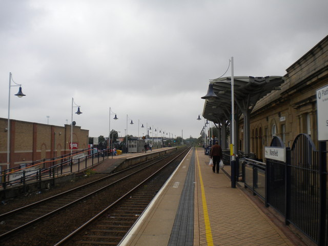
Image: © Richard Vince Taken: 14 Jun 2014
Looking towards Nottingham from the Down (Worksop) platform, showing that the platforms are slightly staggered, and that the facilities are better for passengers travelling towards Worksop than for those heading for Nottingham. Officially named simply "Mansfield", this station is often referred to unofficially as "Mansfield Town" (particularly by train guards) to differentiate it from Mansfield Woodhouse (the next station north of here). This is even reflected in the station's CRS code: MFT.
Images are licensed for reuse under creativecommons.org/licenses/by-sa/2.0
Image Location
Latitude
53.142011
Longitude
-1.19866