St Paul's Hall
Introduction
The photograph on this page of St Paul's Hall by Rose and Trev Clough as part of the Geograph project.
The Geograph project started in 2005 with the aim of publishing, organising and preserving representative images for every square kilometre of Great Britain, Ireland and the Isle of Man.

There are currently over 7.5m images from over 14,400 individuals and you can help contribute to the project by visiting https://www.geograph.org.uk
St Paul's Hall
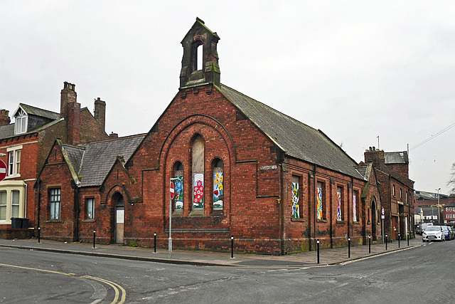
Image: © Rose and Trev Clough Taken: 3 Mar 2013
Situated at the corner of Compton street (left) and Strand Road (right). This late 19th century building was originally a mission hall (the name suggests an association with the former St Paul's Anglican church in Lonsdale Street http://www.imagesofengland.org.uk/Details/Default.aspx?id=386790 ). The hall is currently owned by Carlisle College, and not long after this picture was taken its conversion to a business studies facility was under way http://www.newsandstar.co.uk/2m-more-to-be-ploughed-into-carlisle-college-revamp-1.1116905 .
Images are licensed for reuse under creativecommons.org/licenses/by-sa/2.0
Image Location
Latitude
54.896243
Longitude
-2.930514